LoRa Snow
Using IoT technologies for Search and Rescue operations in mountain environments
The use of wireless devices in Search and Rescue (SAR) scenarios plays a crucial role in the success of such operations, even in harsh mountain environments.
In this context, Avalanche Transceiver Devices (ARTVA) have been adopted for many years to locate mountain enthusiasts involved in avalanche incidents. These tools have gained widespread use among winter sports enthusiasts (such as ski mountaineering, hiking) as well as among technicians and personnel involved in search operations. However, the survival curve for a buried individual drastically decreases after 15 minutes from the moment of burial, making it crucial for rescuers to locate the first ARTVA signal, which guides them progressively towards the estimated burial point indicated by the device itself.
The effectiveness of ARTVA devices has some limitations during search operations, both due to the limited reception range and the impact of certain environmental conditions, including snowpack composition, burial depth, and weather conditions during search operations.
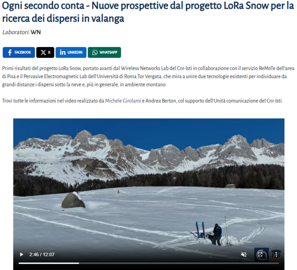
The Wireless Network Lab of the Institute of Information Science and Technologies "A. Faedo CNR-ISTI" in Pisa, together with the Pervasive Electromagnetics Laboratory of the University of Roma Tor Vergata, and in collaboration with ARPAV (Regional Environmental Protection Agency - Snow, Avalanches, and Slope Stability Unit - Arabba Avalanche Center), has initiated an experimentation to evaluate the potential of LoRa (Long Range) technology for avalanche victim search operations.
The objective of the experimentation is to assess the combination of complementary wireless technologies to expedite the victim localization process. The experimentation involves conducting a series of data collection campaigns considering two crucial aspects: snowpack type and burial depth. The collected data will be annotated with a snow stratigraphy profile by ARPAV to standardize the characterization of the snow type present at the time of data collection. The collected data will be analyzed to characterize both LoRa propagation in certain conditions and the possibility of estimating the burial point using localization algorithms.
The second phase of the experimentation involves the use of drones for data acquisition. For this purpose, the REMOTE Service of the Territorial Area of CNR in Pisa (CNR-REMOTE), coordinated by Andrea Berton, will facilitate the development of a stand-alone system required for enhancing the data collected through low-altitude static and dynamic flight acquisitions.
For more information check the project video here (italian audio only).


